December 12, 2011

Finding an al-Shabaab Training Camp on Google Earth. #Somalia, #alShabaab, #gis

After two decades of watching Somalia collapse on itself and descend only into previously unknown depths of chaos, within 2011 it has dramatically transformed.  Undermined by the famine, al Shabaab has been reduced from a fighting force of about 7,000 to roughly 5,000.  Upon abandoning Mogadishu, the group has returned to their roots, utilizing hit-and-run tactics better suited to their small, agile forces.


Although Shabaab has been reduced, their training and recruitment camps nonetheless to proliferate across the south, near Kismayo.  These camps are designed to instruct youth to use weapons and “feature courses on bomb construction that are taught by al-Qaeda members in Somalia.”  To reinforce recruitment efforts, Shabaab has forced the closure of local schools to encourage students to join the battle against the African Union forces in Mogadishu.  Within a recent African Union report, al-Shabaab’s primary training camp was described as located in “Laanta Buro [sic] village at the periphery of Afgoye [sic] town nearly 40km south of Mogadishu.”


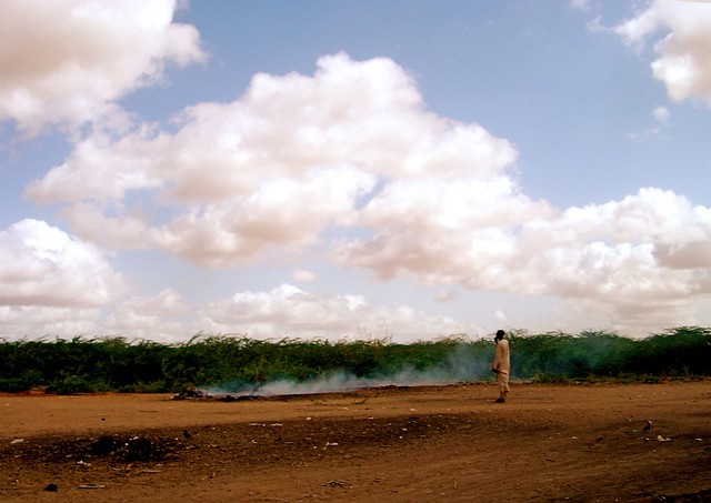
Al-Shabaab Training Camp 
I found this al-Shabaab camp in Google Earth by comparing a collection of descriptive sources. The location of Laanta Buur village is described in a 2010 country report for the UK Border Agency. 


“Heading beyond Agfoye [sic] in the direction of the coastal town of Merka, there are more checkpoints... at Laanta Buur, I am surprised to see that people can travel safely without fear of being ambushed... at Laanta Buur checkpoint, al- Shabaab militia members search men one at a time...”

Somalia has only one road leading from the southern coastal city of Merka toward Mogadishu.  


Following this road it was possible to quickly determine the location of al- Shabaab’s training camp at Laanta Buur approximately 40 kilometers south of Mogadishu, and within the vicinity of Afgooye. 


Laanta Buur contains several features that differentiate this space from the nearby towns and villages. Set back away from the primary road between Merka and Mogadishu by roughly 1⁄2 a kilometer, an airstrip runs parallel to the main road.


The airstrip was once a functioning airport known as “K-50.” For many years, when use of the International Airport in Mogadishu was too dangerous, K-50 was a fully operational airport utilized by many aid agencies to transport supplies into the country. In 2008, al-Shabaab took over the K-50 airport and all flights were suspended.


Laanta Buur Prison
Adjacent to the southern side of the airstrip is a series of large concrete buildings in a Modernist style, surrounded by a trapezoidal wall. The wall has two points of entry, one at the northeastern corner, and one at the southeastern corner. Upon closer inspection, one can discern that the surrounding wall features three guard towers on the northwestern wall.


This structure is one of the two infamous prisons constructed by Sayid Barre’s National Security Service (NSS). Constructed by East German engineers in the 1970s, this foreboding structure contains underground solitary confinement cells and was well known as a center of torture and abuse.81 The NSS utilized this prison as a “tool of intimidation, torture, and executions... the occupants of these centers, during this period, were mostly members of the political elite.”


An Amnesty International Report in 1984 described the acts of torture by the NSS at Laanta Buur and the prison of Labaatan Jirow to have included beatings while bound in a contorted position, electric shocks, rape, simulated execution, and death threats. Many prisoners were held in prolonged solitary confinement, and some cells were permanently dark while others were permanently lit, resulting in hypertension and nervous breakdowns among prisoners. 


A personal account of time spent at Laanta Buur, Mahumud Yahya described it as a very lonely place, where political prisoners were separated from families, friends, and loved ones and were denied decent food and even reading materials. Each prisoner was left isolated in a large, filthy, rectangular room, empty except for a toilet.  Yahya explains, however, that the one redeeming quality of the prison was the large courtyard, as prisoners at Laanta Buur were allowed to sometimes spend time there in the evening, whereas at the prison of Labaatan Jirow, located near Baidoa, prisoners were forced to spend the entirety of their incarceration in solitary confinement. 


Just as Laanta Buur prison was converted into an al-Shabaab training camp, Labaantan Jirow shared a similar history in the 1990s. According to a letter addressed to the UN Security Council in 1992, Labaantan Jirow was a point of operations for the Ethiopian military, which used it as a training camp and weapons storage location. 


Today, the prison appears to be abandoned, yet examination of the road to Baidoa that passes the prison suggests that it remains avoided as the adjacent roadway forks into an informal detour (with smaller fragmentary detours) to circumvent the prison. The additional time, effort, and challenge of driving through the bush would only be worthwhile if the driver had good reason, such as avoidance of an unseen checkpoint. It is also possible that the haunting memory of the site is enough to redirect traffic.

November 22, 2011

Creative Problem Solving in #Kabul, #Afghanistan with #Technology and #Education

Since arriving in Afghanistan in August, I've worked aggressively to launch a new project called the Innovation Lab.  Available to select students at the American University of Afghanistan, the Innovation Lab, or (iN)Lab has been designed to extend education beyond the walls of the classroom and directly into the streets of Kabul. By teaching students to research and assess their own local environments, to work with limited resources and engage stakeholders while providing technological resources, I hope to see (iN)Lab fill a much needed gab in Afghanistan's local-scale development. Today registration opened, along with my own small marketing initiative to drive student enrollment.  But now, just when things were starting to take off, I feel like I've hit a setback.  Not a major one, but enough to be aggravated.

Apparently Harvard University opened their own Innovation Lab (i-Lab) this week, dedicated to launching young entrepreneurs into the public.  Consequently I'm disappointed by the news that their project shares the same name, a similar vision, and has the same timing as my own.  The positive side is that I believe my project is very unique in its conception, as the program draws from my own inter-disciplianry education in art & design, urban planning, computer science and work experience in conflict zones.  Arguably, I like to think that working with Afghan students to facilitate local community problem solving through such creative measures is far more innovative than providing privileged Harvard students with more tools to be financially successful.

I strongly believe in the program I have crafted and I fully intend to see it through.  Yet it very difficult to conduct such a program in Afghanistan. We have finite resources in terms of money and space, problems with security, aggressive traffic, power outages, poor internet service... the list goes on for a long, long time.  Working with so many obstacles, I've aggressively sought partners to contribute to the program, and yet nearly 20 universities, nonprofits, or companies failed to respond or simply said it is too intimidating to get involved.  However, there have been successes, and I am very lucky to have found the interests of spatial technology company Spatial Networks and the dynamic science journalist John Bohannon.  With their support (and hopefully others), hard work, and student dedication, I am fully confident that our program will accomplish its goals.  For now however, I'm left wondering if I should change the name.

September 23, 2011

Deconstructing Kabul's Geography - #kabul, #afghanistan, #gis, #urbanplanning


For the last few days my life has been a nonstop process of researching geospatial technologies and softwares.  Since I was first introduced to GIS in grad school with ArcMap, its amazing how far these systems have come.  Looking into an open source platform, I initially spent my days with GRASS and while impressed by all its toolset, I've been frustrated by its bulky user interface.  Trying to construct informative maps with GRASS made me feel like I was stuck in a time warp, somehow using software from 20 years ago.  I have found more functionality using QGIS, but I'm still just looking for seamless integration and multimedia capabilities.

After my last post I received some emails about some new tools out there and later after a few email exchanges with Anthony Quartararo of Spatial Networks, he introduced me to some of the more exciting options out there an began to realize that a full-scale desktop GIS may not really be necessary.  Thanks to tools like MapBox,  IndieMaps, and Geocommons, it is possible construct interesting maps and have access to a wide variety of data.

For example, by using Geocommons I was able to quickly construct a map of Kabul with the location of each school in the city - or at least the locations in 2004, I haven't located more recent data.  I was then located the map into google earth.  Check it out, its a great way to explore the city.  If you can't see the image below, you can visit the site directly here.

View map on GeoCommons


While exploring my options for analysis and filtration, I also stumbled upon a site dedicated to 360 panoramic photos.  There is a fantastic panoramic of Kabul as shot from the top of TV Mountain - the central mountain in Kabul covered with antennae and satellite dishes etc.   Once again, if there is difficulty  accessing the image, please click the link below.


TV Hill in Afghanistan

September 20, 2011

Finding #Kabul on a Map - The Challenge of Acquiring #GIS Data in #Afghanistan


Lately I've been working hard to improve my skills with Geographic Information Systems.  As a Planner, GIS is a critical tool for researching, deconstructing, and analyzing human settlements.  I've been using GIS for several years, yet was never confident in my ability to utilize the software packages or the datasets.  I could do the work, but it was never intuitive.  Fortunately that is beginning to change.   Recently, GIS has taken on a new role in my life as I've been using it to determine and model advance indicators of insecurity.  While there are plenty of competing organizations and individuals out there hoping to find ways to asess the probability and locations of conflict  before it happens, the truth is, all these systems are bulky, expensive, slow, and not feasible for an individual user.  Yet there is a demand among individual users and so my goal is to create a  reliable statistical tool for common individuals with basic internet access, not to reinvent the wheel of security and defense.

Image via Spatial Networks
Surprisingly, the biggest obstacle hasn't been acquiring real-time data. Thanks to recent developments in social media, it has been remarkably simple to acquire and filter information on recent events as they happen.  When a problem takes place in Kabul, I have full details on that situation within seconds and after only a matter of minutes am able to fully assess its scale and location.  Knowing when and where things are happening is the easiest part.

Google Maps - Map of Kabul
Instead, the biggest challenge has been the acquisition of a useful base map.  In short, maps of Kabul are terrible.  Take for example this map acquired from Google.  You will notice that the streets outlined in yellow do not remotely correlate to the actual roads in the satellite image.  Someone should be fired for this.

WikiMapia - Map of Kabul
Other typical map options are equally limited.  In the past I've been a solid user of Wikimapia, as it allows individuals to upload information and draw vector-boundaries around areas of interest, so its useful for studying remote geographies.  It has been of great value when studying Somalia, and it is clear from the example that Wikimapia is densely loaded with relevant information in Kabul as well. Clearly this is better than Google, yet it has one majore flaw, it does not allow one to export the maps into any useable format.

Options do exist out there in the world to obtain high quality geographic data on Kabul, such as found through Spatial Networks, but if you are like me and must do the work with a limited budget, options are slim.  Using ESRI's online ArcExplorer, I was able to pull up a collection of maps for comparison.  Although they look suitable in the small examples to the right, once you actually begin to zoom inward, all feasibility of use at street-scale is lost.  Bummer.

Today I made the breakthrough and found the winner to be OpenStreeMap.org.  It functions basically like google earth, allows one to customize the map like wikimaps, but best all, allows the user to export the map as an XML file.  The result is that I can integrate this map with my datasets and an actually useful product is in the making.   I'm excited about the prospects of this new tool and look forward to sharing updates on its development in the near future.   If any other GIS users out there have insight on ways to obtain useful data and maps for less-documented places like Kabul, feel free to send me an email or something - I'm always looking for new information.

September 16, 2011

Urban Planning in Kabul - Convention vs Demand; #Kabul, #Afghanistan, #engineering, #transportation

Urban Planning is more than an attempt to solve existing problems.  Urban Planning is about directly shaping the future and I would argue that a sense of vision is the greatest skill needed by Planners.   Yet somehow there is a common disconnect within the discipline, where graduate programs encourage rich brainstorming and imaginative concepts, or individual architectural studios pursue elaborate renderings of the future - but in the end, the final projects are unimpressively droll.  

Frequently this disconnect is due to the over-reliance upon trends, conventions and buzzwords.  In the last 10 years, thousands of Planners have pursued their work within the confines of new urbanism, transit-oriented development, and sustainability.  The danger of course is that Planners can and do make decisions that dehabilitate future development in the name of social advancement, or they fail to account for pre-existing variables because those variables do not fall within the confines of the trend.  An obvious example is the manner in which NYC planner Robert Moses frequently advocated the needs of automobiles over local communities - yet Moses was merely working within the conventions of the era.  In his mind, automobiles and transportation were the most critical asset to urban health and it was impossible for him to assess the negative repercussions.  How many planners today make the same poor decisions as Moses, but in the name of sustainability or economic growth?  

In Kabul, urban planning and development is subject to the same conceptual limitations although the city contains an seemingly more complex array of variables.  I would argue however that the variables are no different than any other metropolis, but rather the organizational methods and logistics  for implementation contain more obstacles.  Regardless, various discipline-centric examples can be found for planning the future of Kabul.  For example, within the proposed project, City of Light, great emphasis is placed upon developing a skyline to accentuate the mountainous horizon lines following the city.  Other proposals focus on typical urban planning strategies such as sector-based zoning, green corridors, centralized business and historic districts and residential living.


Yet why?  Why should Kabul develop according to these guidelines?  In fact, the city has remained in place for thousands of years, and while never emulating the mountains in its skyline, has managed to capture many hearts with its beauty.   Likewise, while I appreciate the sense of vision, I also wonder why the planners simply ignored the most common and visible feature of Kabul - the hillside residential sprawl.

As mentioned in an earlier post, the most obvious characteristic of Kabul is the verticality of its organization.  The hillsides are covered with formally and informally constructed housing, stretching far up the mountains and on all sides.  There are no paved roads up the mountains, rather residents must walk along narrow pathways and hand carved staircases.  Running water is inconsistently distributed but many of the houses have electricity.   To my understanding, the houses along the mountainsides are fairly new, all constructed sometime in the last 10 years.  I was told that majority of these houses are the result of mass displacement in outlying provinces, as millions of people have sought safety and economic opportunities within Kabul.  Unable to secure housing in the central valley, housing has been informally constructed from the bottom upward.  This also implies that the communities are composed of mixed ethnic groups, potentially with a collection of diverse languages and cultural practices.  In addition to localized sociocultural identities, they may also contain localized economic traits, and each community is the foundation for new identity constructions, in particular among the youth who must balance imported identity constructs with local Kabuli characteristics.  

The upward residential sprawl also reflects a spatial settlement structure consistent with an earlier time in western countries.  The wealthy classes live in the middle of the town and the poor live in the difficult to access outskirts.  As Kabul continues to stabilize and develop, this settlement pattern will change.  In many ways, it already has begun to change.  Just as large-scale housing and condominium developments have been constructed along the outskirts of Kabul, near the airport, attracting large segments of the population, the settlement structure between the mountains and the downtown neighborhoods will likely invert.  When improved transportation and utility infrastructures are installed, the mountains will become a site for high-end housing.  Some of the high quality housing will be a consequence of incremental consolidation among existing structures, where  families will continue to expand and upgrade their own housing.  Yet much new housing will also be constructed and as many of the existing legal structures lack a legal claim to the property, inevitable conflicts will emerge when wealthy developers acquire legal titles to property then raise existing settlements in the name  of progress.

Although seemingly separate, one must also recognize that one day a tunnel will be constructed through the mountains, most likely within the next 40 years.  At this time, all transportation is bottlenecked as the city remains bisected by the mountains (illustrated in blue).  Once a tunnel is constructed, the future urban morphology of Kabul will make a dramatic shift, reformulating itself according to new traffic patterns.  New centers of business growth will take root while existing locations will deteriorate.  

If the city can become more integrated with regional developments, such as improved logistical pathways to China and Pakistan, perhaps there will be limited negative repercussions, otherwise one must assume that this aggressive and inevitable demand by the transportation infrastructure will harbor large-scale economic impact.  It also suggests that most urban development plans will be rendered arbitrary, perhaps even harmful.

So what does this all mean?  It means that the most visionary planning will become impotent if the microstructures, points of existing demand, and regional connections are ignored.  It means that the entire functionality of a city can change with a single project when that project is in aggressive demand.  I would argue that within areas of conflict, that these singular interventions can provide the greatest degree of impact, and therefore large-scale planning is fairly limited in its applicability.

Kabul's historic legacy is rooted in its location.  It has always served as the point of intersection between India, China, Central Asia, and Western Europe.  Ultimately, the success of the city has always been founded in its ability to connect disparate points of activity, serving as a critical intersection.  While vision is essential to lead Kabul into the future, this vision cannot exist in a vacuum, and any feasible planning must build upon Kabul's geographic centrality.    Today, urban growth patterns generated by conflict have resulted in a bifurcated city.  In many ways, this division undermines its prospects for stability as the dehabilitated infrastructure supports systems of chaos and undermines the logistics of social order.  Notably, solutions exist - the construction of a single mountain tunnel (high cost, but difficult to sabotage unlike rail transit, and short-term construction time unaffected by seasons) can redirect the entire urban assemblage.  The upfront high-cost becomes proportionately low-cost given the generated value of financial revenue and increased stability.

August 26, 2011

Academic Conferences on #Conflict, Reconstruction, #Architecture and Urban Planning 2011-2012


Every time I look for a conference to present research on the intersection of Architecture, Conflict, and Urban Planning, all the best conferences just happened or I missed the call for papers.  Of course one has to be flexible and try to find fitting venues, but it can be a challenge.  Fortunately this week I found a large collection of upcoming conferences for 2011-2012.  I definitely intend to attend at least one of these and I hope to see you there.

Spaces and Flows 2011. Prato, Italy
Conference: November 17-18, 2011.  Call for Papers Deadline: September 22, 2011.
  • This conference is dedicated to mapping the transformative interchange between the global north and south, attempting to map the dynamic power flows and interactions.

Conference: April 11, 2012.   Call for Papers Deadline September 23, 2011.
  • This broad conference is focussed on issues ranging from globalization to war, peace and reconstruction, social transformation and collective healing through media and imagery.

Conference: March 28-31, 2012.   Call for Papers Deadline: November 30 2011.
  • Rooting the discussion in the context of the Berlin Wall, this conference examines how borderlands and contested spaces are not marginal phenomena, but rather contain complex layers of social, political, and urban interactions.  Research grants available.

Conference: August 29 - September 1, 2012. Call for Papers Deadline: October 1, 2011.
  • Discussion of violence as a communicative form, embedded in the built environment and articulated through broader social processes.  

August 22, 2011

A Vertical Menagerie; #kabul,#afghanistan, #city


As mentioned in my previous post,  the most fascinating characteristic about Kabul is the way in which a single space can contain multiple layers of meaning and value.  Social spaces are loaded with complex combinations of use, symbolism, risk, respite, and value.  Yet another intriguing element about Kabul is the manner in which urban spaces are vertically stacked.  This is of course true of all settlements, yet in Kabul, these spaces and their traffic extend arguably higher, far beyond the rooftops.
All throughout the city are men digging drainage ditches alongside the streets.  The nicest streets are paved with concrete and have drainage canals covered with steel grating along the side.  The lowest order of streets consist of entirely of compacted dirt and rock with no drainage, and throughout the city are mixed combinations of both types.

I know there are some underground sewage systems, but these are only in wealthier or new neighborhoods.  For the most part, roadway drainage (about 2-3 feet deep and 1 foot wide) is the most prevalent form of subterranean infrastructure.  Yet given the large quantity of local infrastructure projects, I can only think of the this space, the space below the ground, as an important part of the urban fabric.

As you rise upward, the landscape shifts from the sewers to the streets, which vary tremendously in quality and traffic.  Neighborhoods composed of international agencies and residents are lined with massive walls, hiding families away behind compounds while the average street is comparable to most throughout the world with shops, restaurants and markets.  Dotted throughout the intersections are large defense posts, often adorned with light weaponry and dusty camouflage netting. Overhead is a tangle of power lines and cell phone towers, with mountains in the background.  Political imagery and signage is typically visible, sometimes entangled with advertising and shop signs.  Large posters of President Karzai, photos of political leaders and signs denoting signs of progress dot the roadways. The dust permeates all spaces and layers all structures with a thin velvet layer.


My favorite time of day in Kabul is just a few minutes after sunset, when distances are suddenly squashed by the fuzzy ambiance of light and the hillsides begin to glitter with electricity.  The massive dark mountains begin to flicker and move as all the houses, one by one, light up for the coming evening.  The call to prayer goes out, mixing with the sounds of children and barking dogs floating upward from the streets.  When the sun goes down, the hills abound with the humanity of family life.

Yet during the day, the hills take on a different sensibility.  Not because the houses, the families, or the people are different, but because in the light of day it is difficult to focus upward eyes upon anything but the large white reconnaissance balloons floating in the sky.  The Eyes in the Sky, large white zeppelin-like balloons called aerostats hover above the city, collecting information from conversations, watching people on the street, and attempting to determine sources of threat from normal social behavior.  Part of me wonders if the data from these balloons is integrated in the DOD's project, Nexus 7, in which complex computational tools attempt to measure common social behavior and extract outlying incidents as a means to predict conflict.  

When not focussing attention upon the aerostats, then my vision is often distracted by the helicopter traffic.  Always traveling in pairs, I've quickly learned to distinguish helicopter typologies, and more often, learned that when the sound of chopper interrupts conversation to wait until the second passes before resuming.  


I've never been anywhere in which I felt the airspace was as much a part of the general urban space as I have found in Kabul.  So often the energy of a community ends mid-way up the tallest buildings, and yet here it seems to just go onward into the clouds.

August 19, 2011

Welcome to Kabul: #Kabul, #Afghanistan,

First impressions are always a little complicated.  Sometimes they are perfectly accurate and sometimes they are completely off-base.  In a place like Kabul, it can be far more difficult to know if such impressions are remotely accurate.  (Unfortunately I lost my camera or it was stolen from my luggage, so I cannot supply any photos at this time.  However I will certainly add more later).

The only thing I can say about Kabul is that each space is loaded with inconsistencies.  A street corner might contain children playing, old men talking, a successful business, an armed security guard, goats on the street and a new glass building.  The greatest danger is that it generally doesn't feel dangerous, yet war manages to permeate the landscape.  Not through obvious means - the buildings are not riddled by bullets etc., but rather, each building is so heavily fortified and the pretense of security dominates.  The sense of risk and aggression is 'omni-present' rather than 'ever-present,' whereas war saturates all things merely as atmosphere and does not otherwise obstruct or become manifest in daily reality.

There were some explosions today and one was audible from my house, yet it didn't actually change anything. Life carries forward for all those who do not take part in the conflict, which is ultimately the majority.  Consequently, the greatest threat I believe one could have is to become complacent and become lulled into a sense of safety and thus be arrive at the wrong place at the wrong time.  After all, safety is not a feeling, it is a condition and the best determination of security is not to measure one's feelings, but rather to vigilantly assess and monitor the surrounding environment.  Even more so, to pay attention to where one is located and how one interacts in that environment is critical, because there are always ways to adjust personal behavior to mitigate threats before they happen and to reduce the potential for threats to become actions.

As time goes by, all such things will be in flux, and so will my understanding of this city.  Yet based on the last 24 hours, if I have one goal, it is to always remain vigilant and objective as long as I continue to make this my home.

August 12, 2011

Stability Planning amidst Global Conflict and Chaos: #London, #riotinlondon, #

Poverty and Riot Clusters UK
Massive riots in the UK. 


Uprisings in the Middle East and North Africa. 


Conflict and famine in the Horn of Africa.


Poverty and conflict in South/Central Asia.

Riot Activity Distribution UK
The situations listed are all unique, with individual drivers, contexts, and actors.  Yet there remain consistent trends among these situations.   It is easy to quickly fall into a Marxist critique of all situations, wherein the conflict is described by class battles, especially considering how insecurity and poverty are strongly correlated.  One can see from a map of wealth distribution in London (the bluer the richer, the more red is the most poor) that the riots are most concentrated in low-income neighborhoods.  Yet as riot participants are mobile, it is difficult to determine from afar who is participating etc.  A broader picture of riot-related activity may reveal that the mobility of its participants and the broad distribution of activity negates the viability any land-use/gis analysis.

The UK is generally considered to have a stable and accessible government with a low corruption index and is considered one of the most developed nations in the world.  Consequently, one can only assume that the the riots are grounded in stresses between internal social structures, and is likely based on a socio-economic dilemma.  All nations suffer from such conditions, but in general, the international community would become distraught if the UK government attempts to suppress the riots through aggressive or military intervention, as has been the approach to suppressing protests and social upheaval in Syria, Libya, Iran, and so on.  Consequently the government has been left to explore other stabilization options, such as technology-based solutions and an expanded police presence.  It is reasonable that the government would implement a large body of force to secure the city of London from future disruption, but then what?  How do things change so that it stays pacified and such events don't happen in the future?

Theorists and practitioners always want to determine and address root causes. The greatest difficulty is that is it nearly impossible to determine why the riots are taking place.  If one were to ask 100,000 rioters why they are participating, there would be 100,000 responses.  Responses could vary from deeply rooted experiences of social strife and racism, or for many, they could simply be youth looking for a good time who want to steal a television or get  a new ipod.  Consumerism and "first world problems" concerning cultural identity and alienation could be a major undercurrent.  Regardless of the reasons underlying the riots, the question emerges, is there an alternative way to pacify and avoid future riots?

An urban planning approach would advocate the fusion of participatory processes with local community institutions to create pathways for social mobility,  community cohesion, and economic growth.  The difficulty however is the determination and mobilization of viable institutions.  Many classic institutions - such as churches, schools, and local government - simply lack the capacity to facilitate any real change.  With the constant slashing of institutional budgets offset by raising demands in services, one could argue that the riots taking place in the UK are not the consequence of poverty, rather that the riots are the consequence of incapable local  institutions.  Such institutions are not inept, but in contrast are merely unable to accommodate demands.

One could change this situation in a variety of ways.  There could be an effort to return classic institutions to function on par with demand.  One could also work to create new institutions altogether, although this often requires new infrastructure such as sports facilities, buildings for meetings and administration, recreational spaces.  Even if consumerism were a driver of conflict, are there shopping centers and jobs for youth to indulge themselves?

Unfortunately no matter the approach, it requires resources to be injected into the community.  To measure the amount of resources injected in relation to the rate of absorption and local re-production reveals that any viable solution will also require a sufficient body of time.  Ultimately the only way to offset that time-demand is to quickly allocate and facilitate the already functioning nodes of production (churches with successful youth groups, community outreach programs, amateur sports leagues).  Of course this is easier said than done, and it still requires a vast supply of resources.  But in the end, good governance is not enough, as a community needs not only a shelter over its head, it needs to stand on a strong foundation.

August 9, 2011

Analysis of #alShabaab withdrawal from #Mogadishu; #Dadaab pushed to the Edge


Quite a bit has taken place within Dadaab and Somalia in the last few weeks and it is  difficult to summarize everything.  The Dadaab camps have received a great deal of media attention while the regional draught rages.  Somalia has a long history of internal strife, yet arguably the current draught is far more damaging than past instances as the country no longer contains sufficient infrastructure for aid agencies to deliver services.  The inadequacy of infrastructure prompts dramatic repercussions, not only in terms famine relief but also through the inability to provide broader public health support.  With the surge of displacement, many have been refused admission to the camps, as there are not enough resources available.  The constant influx of refugees also continues to place great strain on the local communities.  

Within Somalia there have been a variety of reports on al Shabaab preventing the delivery of aid.  In addition to reports of fake NGOs attempting to take advantage of the incoming aid money, Shabaab has also listed several agencies to be banned with the area for attempting to do more than deliver basic assistance.

Most notably, al Shabaab has withdrawn from Mogadishu. There are still reports of fighting, yet the group publicly announced its withdrawal, citing a change in tactics and to save civilian lives.  The city is not yet safe for return as the group has established checkpoints outside of the city, intercepting returnees for money and recruitment.   It is suspected Shabaab has been heavily affected by the drought and cannot sustain combat within the capital city while some analysts argue that Shabaab suffers from divided leadership.  This is similar to the 2009 when the group withdrew from Kismayo, abandoning training camps and strategic points. 

I suspect the withdrawal may be a true change in tactics rather than a sign of loss or weakness. Considering that Shabaab fighters have ambushed AMISOM soldiers sweeping into newly vacated areas, taking advantage of the urban terrain, this may be a legitimate attempt to maximize available resources and keep AMISOM forces off-balance.  

Shabaab's quick acquisition of power within Somalia was possible because Shabaab groups concentrated their forces in urban areas where they could utilize transportation and communication resources, tap into ports and markets, and tax local populations.  As the Somalia conflict developed and became more binary between Shabaab and the TFG, Shabaab's approach to conflict became less networked and more one-dimensional.

Since the TFG is a major supplier of arms to non-state groups within Somalia and that unpaid soldiers often sell ammunition for goods, there is a sufficient flow of arms and ammunition throughout the region for Shabaab to continue its military objective yet there must be an adaptation to the changing geography.  Somalia presently has 5 major cell phone providers, populations have shifted from the urban core to the corridors between towns and scattered among IDP camps and Mogadishu only contains a small fraction of its original population. 

 
al Shabaab Supply Trench in Mogadishu, Somalia
Amid the geography transformation, Shabaab has grown and annexed territory yet not adapted to the changing resources.  Simultaneously, the conflict has slowly become more symmetric, with Shabaab and the AMISOM forces fighting along a frontline in Mogadishu, utilizing a mixed combat method of hit-and-run tactics and trench warfare.  AMISOM has been working to cover the trenches before any future return by Shabaab troops.

The sudden withdrawal may be a sign of weakness.  Yet it may also be an indicator that the conflict is about to change abruptly, to become something far more unorthodox and challenging than the TFG is equipped to confront.

**Update: Just a few hours after posting this reports have rolled in that multiple attacks have taken place in Mogadishu with al Shabaab utilizing hit and run tactics and hidden explosive devices.

July 19, 2011

#Dadaab Research and Information, #Somalia #Refugees, and #Architecture


Events within the Dadaab refugee camps have reached a fever-pitch in the last few weeks.  Or more accurately, there has been a surge of interest in the Dadaab camps, as circumstances have always been dire. I have lately received many emails from those interested in working at the camps, designing solutions, or basic requests for information.  

At the moment I am traveling and have limited access to a computer so I apologize for the delayed responses.  However this week I added a new page The Humanitarian Space, specifically compiling some resources and information about Dadaab.  The resources are drawn from my own work or is work on which I am quite familiar and can answer questions.

In the next few days I will provide a more thorough background on recent events,  information about refugee camp design, and answer some of the most recent questions.  

#Stuxnet Lessons for Urban Planning 2 of 2


In the previous post I gave a brief overview of how Stuxnet worked and discussed some of the perils Urban Planners face within complex conditions, notably within conflict.  Below is a closer look at how Stuxnet can apply to urban planning.


Stuxnet and Urban Planning 
1. Stuxnet was designed and operated reflexively, rather than strategically.  Its code was structured like a Russian doll, with one layer contained with in another, and so on.   Configured as such, it had the ability to continually unload an additional set of internal tools when the situate presented itself.  Yet when the conditions were not present, the structural integrity remained intact. 
  • Too often development plans are developed and executed while overly reliant on contingent variables to maintain their integrity. If Part A occurs properly, Part B will go into effect... yet if Part A doesn't happen, the project is at risk of failure.  This is partly the fault of the discipline of Urban Planning and its tradition of  creating"Master Plans," long term projections into the future with a constant effort to fine tune socio-economic conditions in space.  Yet as the conditions constantly change and the implementation of Part A will have unforeseen effects elsewhere in the urban space, master plans are rarely equipped to meet the changing demands of the urban environment and are doomed to fail.  

2. Stuxnet not only penetrated multiple systems, it provided opportunities to change in response to those systems.  The code maintained a series of entry points in the event that the present layer of the 'russian doll' doesn't quite fit the conditions.
  • Markets do not exist in an equilibrium, neither do the less tangible social forces, therefore it is essential that plans are designed and implemented as fluid enterprises.  Rather than craft a plan that is project-oriented, consider how projects function as a larger process, and thus changes and tweaks are determined in terms of maintaining momentum with the process, not within the operations of a single project.  In other words, to craft a successful small project, consider it at a regional scale. Evaluation of the project and suggestions to change  are best designed in terms of regional necessity, not at the smaller scale of 'project success.'

3. The systems exploited by Stuxnet varied in Code (as operating systems) and as networks (peer-to-peer, hardware based, intranets, closed and open systems).  It jumped between code and network style, adapting to not only new terrain, but new communication protocol.

  • Planners in conflict need to visualize human settlements as  4-dimensional and not as static compositions.  The traditional overhead map will only provide a fraction of the information necessary.  If the problem is defined by conflict between two social groups, situate these groups in a space, and visualize their interactions within that space over periods of time.  The environment will inform the actions of those groups.  Over time the environment and the groups will influence each other and thus create a new set of conditions. The problem will again change once an intervention is introduced.  
  • This doesn't exclusively apply to conflict cities.  If one were to count the bus stops on a street then count their occupancy at different times of day, and each day of the week, a succinct pattern would emerge.  Introducing a new transportation option would change this pattern.  Yet before a new option can be introduced, such as alternative transport, additional buses, or an alternative route, the pattern must be first determined in terms of space and time and a variety of research methods may be used to acquire this information.

4. Spend less time attempting to building sectors and invest more time into the linkages.  Embedded within Stuxnet were three different layers of code to exploit three different situations.  It used the connections between Windows OS to Siemens and then to PLC.  Its primary set of tools took action at the final stage.
  • Likewise the function and productivity of any sector is only as strong as the transition point from one sector to another.  Rather than devoting hours to the study of transportation and a separate study on economic markets, condense efforts to understand how markets flow and interact based on available transit corridors.  

5. Identify target indicators within those linkages, but these indicators  must also be 4-dimensional.
  • To continue the above example, a rapid observation of wheel thickness among vehicles will tell you the condition of roads, the distance between production and supply points, the amount of wealth generated within processes of exchange and the frequency of exchange. The better the conditions of all circumstances, the thinner, lighter, and newer the tires on bicycles and cars.   This single indicator can inform the health of sector linkages and simultaneously communicate the health of individual sectors.  It should be noted that the indicator itself may actually serve as an ideal point of intervention.

6  Stuxnet simultaneosly spread through multiple networks so that points of failure were inconsequential. While the mechanisms of the intervention may be complex, the linkages need not be.    If an intervention is crafted upon a continuous series of dependent variables, it will not succeed.  If an intervention directly impacts multi-sectoral linkages and multiple locations at different points in time, it will have a higher probability of success.  It may require fine tuning in some locations or at some points in time, but such changes need only be subtle and responsive.


The greatest difficulty of behind planning an urban intervention while utilizing the Stuxnet approach is the challenge of measuring the impact of the plan.  Stuxnet was designed to relay information back to some website databases, yet working in a community does not provide the same immediate information supply. Rather one can only measure the impact of the project by assessing the actual problem at hand, such as fluctuations in conflict, market stabilization, transportation flows, and the production of goods.  The problem emerges when specifying causality, specifically connecting the value of the project to the mitigation of the urban problem.   Certainly it can be done, but it will require creative thinking.  After all, if one simply continues to add more layers of indicators, markers, measurements, links, etc. to the production cycle, the project will lose its streamlined sophistication and  become too self-burdened to operate efficiently.

July 14, 2011

#Stuxnet lessons for Urban Planning in Conflict. 1 of 2


In July 2010, the Stuxnet computer worm surfaced as a powerful destructive force that targeted specific industrial systems.  While most computer attacks are constructed to exploit the weaknesses of Microsoft systems, Stuxnet is unique because it functioned on 3 different layers.  It used Windows OS in the intial stage and then  transfered to another operating system, Siemens WinCC or PCS7. After installing itself on WinCC, it then installed itself on a PLC device (Programmable Logic Controller).  PLC's are basically small computers designed to operate industrial equipment and generally do not receive commands through a network.  Although all the details of Stuxnet are not determined, it is clear that it sought PLC's with the intent to control frequency converters and thus modify the speed of mechanical motors. Stuxnet also relayed false information to monitoring devices so that everything appeared to function as normal.  Upon discovery many feared that Stuxnet had the potential to bring global industry to a halt

Impending doom is never appreciated, yet in the case of Stuxnet, it was also quite unlikely. Remarkably, Stuxnet only affects machines with particular characteristics and that do specific tasks and there are few industries in the world that contain such characteristics.  It is believed that Stuxnet was created by a western government to undermine Iranian attempts to create nuclear materials for combat purposes.  Some suspect Israel, others the United States, yet the designer of of the virus is completely indeterminable.  

What is apparent however, is that the creator had expansive resources, a specific objective, and was faced with significant limitations.  If destruction or at least the tampering with Iran's nuclear facilities was the intended objective, the designer had to create an streamlined yet sophisticated tool to modify the mechanics of uranium enrichment.  Most importantly, this enrichment system is not accessible online, and attack had to be introduced at the periphery and then distributed through continued USB use and internal networks.  The virus likely reached its final objective, considering Iran began having difficulty in May 2009 with operational centrifuges (IFPM Report, 17).  Stuxnet was only noticed a full year later.  Roughly 1/5 of their centrifuges were destroyed.

Stuxnet, Urban Planning and Conflict Stabilization
Urban interventions confront a variety of constraints and limitations, such as limited budgets, poor communication and disruption among social groups, and lack of capacity for implementation.  At all times, urban planning also has to straddle the void between top-down 'expert' interests and the will of the 'bottom-up' community.  No matter the situation, Urban Planners nearly always use the same problem solving strategies.  Planners consistently rely upon a Logical Framework Approach or combine this with Participatory Action strategies.  These strategies are typically sufficient, yet there are many times in which the obstacles are too large or the network of contributing factors is too complex.


I recall an architect who constructed IDP shelters in Somalia. She said that she "didn't bother asking people what they need or want because it is a waste of time, she just gave them the best solution" and when I asked about that solution, the area was first bulldozed of all surviving vegetation, drawn into a grid and an Australian engineer introduced a concept for mud brick houses.  Local acts of violence escalated shortly after as no one had shade from the hot desert sun and small fights between frustrated youth grew into tribal combat. When the houses went up everyone was relieved until families began to die from collapsing structures. Of course the architect wasn't around to witness the consequences of her decisions as she had already moved on to other projects.  Clearly, the most direct and expert-oriented solution is not necessarily the best solution.

Looking at Stuxnet, I see a product that imitates a perfectly constructed urban planning intervention. Severely constrained by technology, geography, and security, destruction at the Nantez nuclear production plant required a clever, unorthodox design and  streamlined  precision.  The designers had to work as a team to mobilize dispersed resources, to consolidate those resources in a fashion that could penetrate a complex network and accomplish a specific objective with re-percussive impact.  Although Stuxnet was introduced at a single point, the fluidity of its design allowed simultaneous access to multiple communication networks, applying to those that fit the targeted criteria and skipping others. At its end point, it made only minor tweaks to an already existing process, barely noticeable to the population yet large scale in consequence.  How can Urban Planning function in a similar manner? Planning interventions within conflict could greatly benefit from the lessons of Stuxnet.  

July 13, 2011

#Somalia: Hot, Dry and Dangerous


The last few days in Somalia have been like any other - hot, dry, and dangerous.   The aggressive drought has displaced thousands, crowding the Dadaab camps and bringing the ongoing humanitarian crisis to an unprecedented level.  At the same time, it is clear that the US government is slowly focusing more attention on the region, recognizing the increasing threat that this nation poses to international stability.  Here is a quick overview of current conditions.

Drought
Drought (red) concentrated in South
The drought has continued to devastate Somalia to such an extent that al Shabaab has even welcomed aid agencies to return to the region.  While agencies such as WFP are mobilizing, it doesn't appear that everyone got the message, as some Shabaab fighters have continued to capture aid workers.  The question remains if Shabaab will continue to have the significant power to administer the region, as head commander Ahmed Abdi Godane discussed problems the group is facing on a Shabaab friendly radio station.

The current dry spell is far worse than previous years, such as th early 1990s, as there is no longer any alternative infrastructure to absorb the catastrophe.  Although the western regions have seen a little rainfall, the Juba valley remains dry. While international agencies scramble for access, the TFG finds it has too little resources to make an impact, evidenced by TFG soldiers offering their own paychecks over to afflictedfamilies. While over 350,000 displaced people seek protection in the Dadaab refugee camps, the population will likely continue to increase as nearly 75% of the nations harvest is expected to fail.

US Intervention
CIA conducting interrogations in Somalia.  As shown within a recent congressional hearing, the US Government believes to officially recognize the  strengthening  regional links between Somali militants and al Qaeda and the devastation of the nation is globally permeating.  he CIA have been increasing their presence and interventions in the region, most recently training TFG soldiers in counterterrorism strategies and intelligence collection.  Many of the interrogation practices are supposedly undertaken in an airplane hanger adjacent to the airport and in the basement of the TFG's National Security Administration.  The NSA basement has a long history of abuse and torture, infamously known as godka, the hole, while under the rain of dictator Siyad Barre.  

Al Shabaab
Moderate pro-government militant group Ahulu Sunna Wal Jamaa (ASWJ) has elected a new leader, Sheikh Aydarus Sheikh Ahmed Siid Warsame, and vowed to fight against al-Shabaab in Gedo region.  The former leader was killed in an ambush by Shabaab fighters. 

In related news (ambushed convoys), it was confirmed that the helicopter attack near Kismayo was actually a drone attack upon an al-Shabaab convoy, targeting and killing on of the top leaders, Ibrahim al Afghani.

Media
Below is a brief video from BBC.  The story is covers the general state of conditions but the footage is quite strong.  The beginning features a spectacular flyover of Dadaab.


How to Build Something from Nothing

Trying to explain my day job to the American Geographical Society at Geo2050. November 2015. Everyday I have to give someone a 15 secon...